Main Contents & Search
A Native of Winby
Jim's Little Woman
.
"Jim's Little Woman" by Sarah Orne Jewett
This documentation may prove interesting on several grounds. Jewett has set the story at a quite specific time in the history of St. Augustine, when the city was quickly changing from a quiet, old town by the sea into a busier tourist destination under the influence of Henry Flagler. From 1884 to 1890 and after, Flagler built two large and luxurious hotels in St. Augustine, completed a direct rail connection from New York to St. Augustine, and in numerous other ways changed the shape of the city (See Graham 2004, p. 23, and also "The Flagler Era"). Jewett's story, therefore, enriches the record of this historical transition.
Jewett clearly sets the story after the opening of the Ponce de Leon hotel (January 10, 1888). All of the story's events, therefore, should occur between Jewett's first visit in 1888 and the date of the story's publication in December 1890. One of the remarkable features of this story is that Jewett has incorporated so much detail about the city in about 1890, from features of and events at the Ponce de Leon, to the appearance of the harbor and even the construction of new jetties to improve the harbor entrance. Though Jewett fairly often sets stories in specific locations that include accurate geographical detail, only a few offer so much verifiable information about a known site.
What follows are all of the references the story makes to specific places, activities and events in St. Augustine, with brief discussions of each, indicating their factual foundation. These discussions are designed mainly to illustrate the accuracy of Jewett's portrayal of the city, but they also may offer starting points for further study of the story.
Print sources used below that are not currently available on the Internet
Beth Rogero Bowen and the St. Augustine Historical Society, St. Augustine in the Gilded Age. Charleston, SC: Arcadia Publishing, 2008.
Thomas Graham, Flagler's St. Augustine Hotels. Sarasota, Fl: Pineapple Press, 2004.
Thomas Graham, Mr. Flagler's St. Augustine. Gainesville: University Press of Florida, 2014.
Karen Harvey, America's First City: St. Augustine's Historical Neighborhoods. Lake Buena Vista, FL: Tailored Tours Publications, 1997.
Karen Harvey, St. Augustine and St. John's County: A Pictorial History. Virginia Beach, VA: Donning Company, 1980.
Orientation: Maps
Up is west on this map
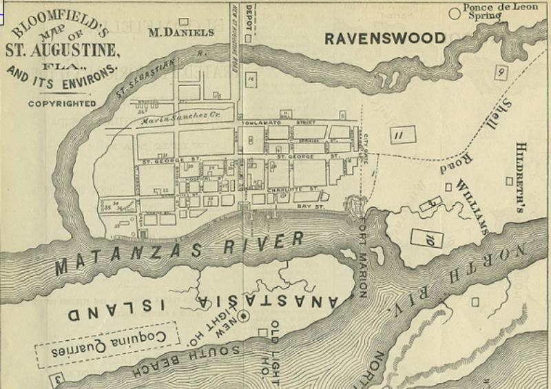
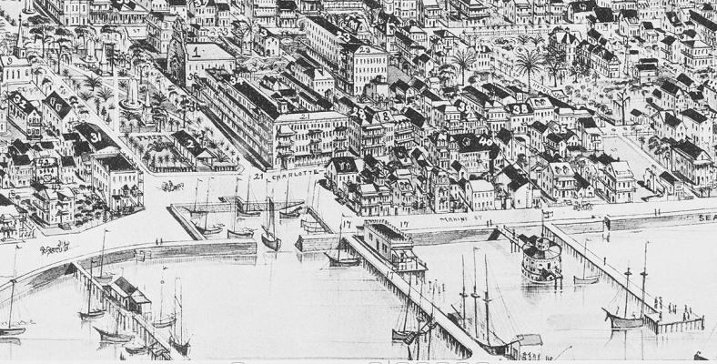
This map is from Max Bloomfield's Illustrated Historical Guide embracing an account of the antiquities of St. Augustine, Florida...; the image is available courtesy of Augustine.com. Though this map shows the city significantly before the Jewett and Fields' visits and therefore not exactly as it appeared to them, it is useful for showing most of the landmarks mentioned in the story. Following is a key for places mentioned in the story or in explanatory notes.
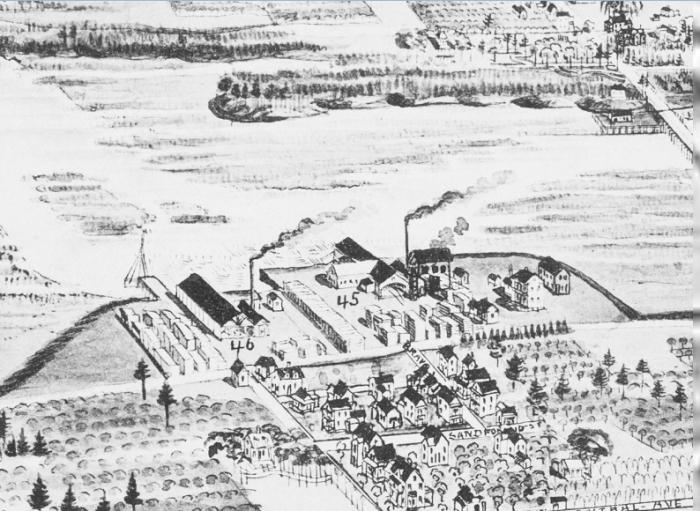
East bank of the St. Sebastian River
Across the river from M. Daniels is the approximate location of the St. Sebastian Saw and Planing Mill and the St. Augustine Sawmill. Jim at least once helped load the Dawn of Day with lumber at one of these mills.
Orange groves
Upon first seeing St. Augustine from the harbor, Marty thinks some of the green she sees must be orange trees. Whether she really could have seen oranges in quantity from the harbor is difficult to determine. However, any of the empty spaces in the town on this map could have been orange groves, for oranges were cultivated in most suitable areas. Graham (2014) notes that the Markland property, owned by city leader and associate of Henry Flagler, Dr. Andrew Anderson, consisted largely of orange groves and that these remained near the Ponce de Leon during 1888-1890. Anderson owned much of the property between Tolomato Street and the San Sebastian River on Map 1. Furthermore, like Jim and his grandfather, many people who had gardens also had an orange tree or two.
Maria Sanchez Creek
The northern end of this creek marks the future location of Henry Flagler's Alcazar hotel and casino. To the north, across King Street, will be the location of the Ponce de Leon hotel. See maps below.
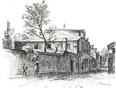
St. George Street (sometimes called George Street in the story)
King Street crosses St. George Street in approximately the middle of the map and of the old city, and forms the southern border of the Plaza de la Constitucion.
At the north end of George Street is the City Gate, called the "old gates" in the story.
Charlotte Street
Running parallel to George, a block closer to the bay and the Matanzas River, Charlotte street marks the eastern edge of the Plaza de la Constitucion,
A block north of the Plaza is Treasury Street, which runs through from Bay St. to Tolomato St. (misspelled on the map).
Another short block north from Treasury Street is a short lane that passes only between Bay and Charlotte Streets. Though not readable on this image, one can see in the enlarged detail below that this is Baya Lane, which is in the neighborhood of Jim and Marty's home. In the detail below, #18 is the Cathedral Basilica of St. Augustine. The cathedral faces into the Plaza de la Constitucion, on Basin Street.
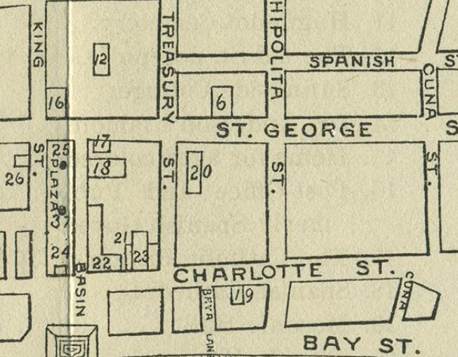
Detail from Map 1
Jim and Marty's neighborhood.
Bay Street (called Marine Street on some maps and Avenida Menendez today)
Jim and Marty's house is said to face a narrow lane and to have a window toward the harbor and is near enough to the plaza that one can look from a first-story window and observe ships entering the harbor, docking and unloading. This places the house on Bay Street and within sight of the several piers between Baya Lane and the Plaza.
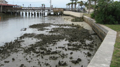
The sea wall runs along Bay Street from the Army Barracks, at the south end of the wall, to Fort Marion at the north end.
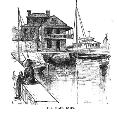
A square inlet along the wall, indicates the Plaza Basin, which is at the east end of the Plaza de la Constitucion.
Anastasia Island
Old Light Ho.
New Light Ho.
Coquina Quarries
After 1887, new jetties were constructed to extend into the harbor from the north end of Anastasia Island and the south end of the facing island (labeled North Beach on the map, now called Vilano Beach). Jim worked for some time on these jetties.
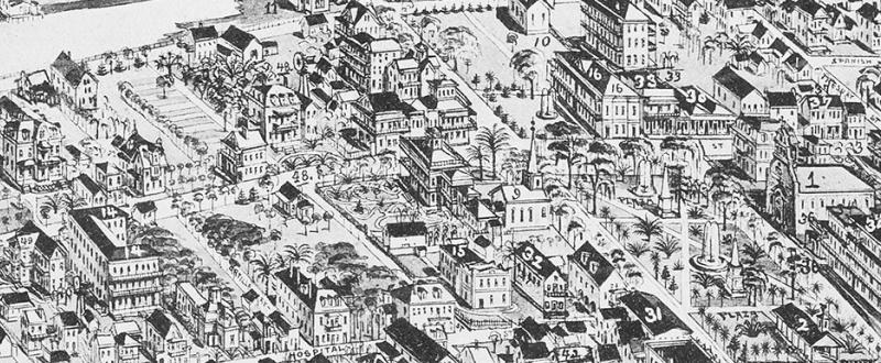
Up is east on this map.
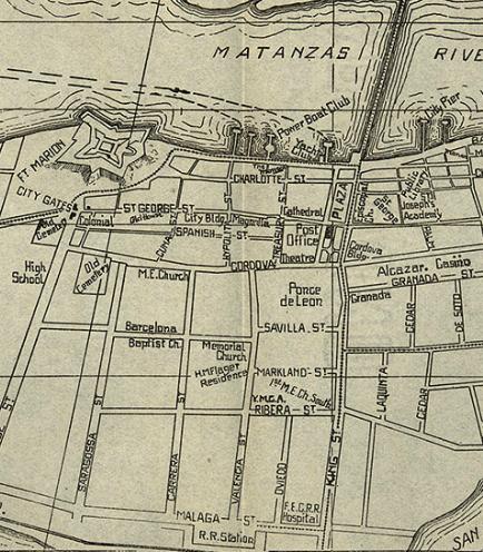
Wylie Tourist Map courtesy of Augustine.com
This map comes from well after Jewett and Fields' 1890
stay in St. Augustine. For example, the first bridge
to Anastasia Island was completed in 1895 (renovated
in 1904), in time for the friends' final stay in 1896.
However, this map shows a number of sites in the story that
are not on the pre-1882 map, several resulting from changes
made by or under the influence of Henry Flagler, as he
developed his tourist-centered enterprises.
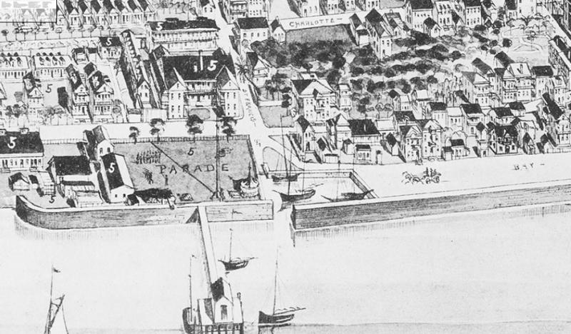
The Harbor
This closer look gives a fuller view of Fort Marion and the piers along Bay Street. By
the time this map was made, an extensive fire had destroyed
the Baya Lane area, and the
lane no longer existed.
St. Joseph's Academy
Located on St. George Street, south of the Plaza, near the
Public Library, this is the school run by the Sisters of St. Joseph, who are
mentioned in the story as teaching at a school near the
Plaza.
The Ponce de Leon Hotel stands within the block bounded by Cordova (formerly Tolomato), King, Savilla (Sevilla), and Valencia Streets.
The Alcazar Hotel and Casino are across King Street from the Ponce de Leon. Though not mentioned specifically in the story, this is one of the other large hotels with towers.
The railway station on Malaga St. at the west end of Valencia St. was new in 1890, a stop on Flagler's Florida rail routes that were reaching southward toward Miami and eventually Key West. Presumably, this is the station at which Jim arrives after his long absence.
Not shown on the map, at the northwest corner of Ribera and Valencia Streets stood the steam laundry for the Flagler hotels. The story suggests that Marty may have been working there when she heard that Jim had died.
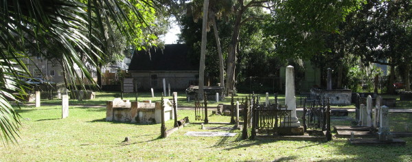
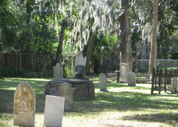
The Old Cemetery
Also known as Tolomato Cemetery and the Old Spanish Cemetery, on Cordova St. between Orange and Saragossa Sts., this is where Jim's mother and grandparents are buried.
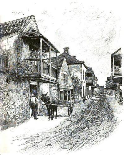
Their old coquina house near the sea-wall faced one of the narrow lanes that ran up from the water, but it had a wide window in the seaward end, and here Jim remembered that the intemperate old sailor sat and watched the harbor, and criticised the rigging of vessels, and defended his pet orange-tree from the ravages of boys.
... and picked the oranges and planted their little vegetable garden....
There was a quiet little colored girl, an efficient midget of a creature, who had minded babies for a white woman in Baya Lane, and was not without sage experience.
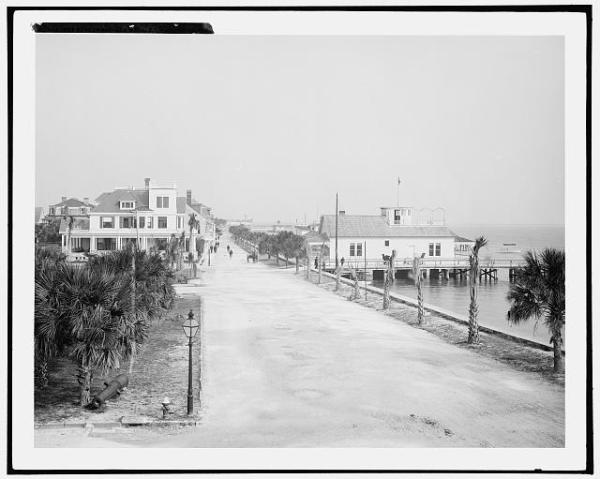
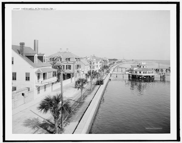
Looking northward along Bay Street, the Plaza on the left, sea wall on the right.
Detroit Publishing Company Photo from the Library of Congress.
Dated 1904
That evening they walked up Bay Street to King Street, and round the plaza, and home again through George Street, making a royal progress, and being stopped by everybody.
These passages indicate the location of Jim and Marty's neighborhood with considerable precision. The 1885 Birdseye Map of St. Augustine (made available by Augustine.com) provides a wonderfully accurate depiction of the old town in 1885.
Up is westerly.
What Jewett calls Bay Street is identified here as Marine Street, running next to the sea wall along the bay.
Baya Lane (see Map 1 detail) is mentioned in the story as the address of a neighbor who recommends the Black girl Marty hires to help with her children. On Map 3, Baya Lane is difficult to locate. Treasury St. would meet Bay / Marine at the private bathing house, the round building in the river at the end of the short pier. Baya Lane, therefore, would meet the northernmost pier, as is confirmed by Map 1 Though the story is not perfectly clear on this point, it suggests that Jim and Marty's house is near Baya Lane, but not necessarily on it. However, period maps show no other lane in this neighborhood, though both Treasury and Cuna Streets between Charlotte and Bay are narrow enough to be called lanes. In any case, the story clearly implies that Jim and Marty live at the corner of Bay Street and a narrow lane somewhere near Baya Lane.
Given this information, one can observe how Marty discovers the Dawn of Day unloading at the long pier, probably at #17, as she leans against the door of the cathedral. When she walks toward home up Bay / Marine after learning of Jim's supposed death, with the blinding reflection from the water on her right, she must be moving northward from the pier. And, when she and Jim make a "royal progress" after his return, they must walk down Bay to the Basin (east of the Plaza), then around the Plaza, turn onto George Street at the west end of the Plaza, pass the cathedral grounds and proceed up George Street toward their home. However, this is made somewhat ambiguous when the story specifies that they walk "up" Bay Street to the Plaza.
As their coquina house is said to face a narrow lane and to have a single window onto Bay / Marine and the harbor, one may be tempted to choose a likely building from this map.
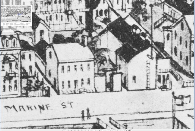
Along Marine/Bay north of the Plaza, facing the northernmost long pier, is a building with a single window onto the bay, such as Jim's grandfather might have looked out of to observe shipping in the harbor.
The enlarged detail above shows how the two-story building with the single window facing Bay Street resembles the house Jewett identified as the home of Jim and Marty. To the left of the house a high wall encloses a garden. This garden appears, however, to belong to the house on the left, which faces the bay with a number of windows. The lane seems to run between this wall and the house with a single window.
Though this area tantalizes with its location and configuration, it is unlikely that Jewett actually imagined this particular building as Jim and Marty's coquina house. Looking closely, one notices the attached ladder and the flagpole, suggesting that this is a commercial building. This is confirmed by a Sanborn map from 1884, which identifies this building as an ice-house, which may account for the ladder and flag-pole on the Bay St. side. The small building with a street door and two windows, just to the right of the ice-house, is identified on the Sanborn Fire Insurance map as a saloon. This map locates only a few dwellings on Bay Street in this part of the town, which was in fact, mainly a commercial area.
While Jewett's descriptions fairly clearly place the home of Jim and Marty in this area, Jewett seems to have created and placed there the sort of house she wanted for the couple. At this level of detail she fictionalizes in two ways, in placing their residence on Bay Street and in the particulars of its appearance. On the 1885 Map 3, there is no house on Bay Street in this neighborhood that fits the description Jewett gives of the coquina house.
... he mentally cursed the boys who came to steal the old man's oranges, there in the garden of his own empty little coquina house.
It was not long before the dismal little, boarded-up, spidery coquina house was as clean as a whistle, with new glass windows, and fresh whitewash inside and yellow wash outside...
... they had two boarders, steady men and Jim's mates, for there was plenty of room; and the little woman was endlessly busy and happy.
Some young women hired all her spare rooms...
These passages seem ambiguous about the size of the house. Though it is described as little, it has room for Jim and Marty, a child, at least two boarders, and possibly more.
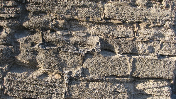
Like many structures in old St. Augustine, the house is built of coquina limestone. "Coquina is a form of limestone composed of broken fragments of fossil debris. Most fragments are about the size of gravel particles (greater than 2 mm/0.08 in) and are usually shell material -- coquina is derived from the Spanish word meaning "cockle" or "shellfish" -- that has been abraded during transport by marine currents and waves. Coquina fragments are easily broken. Soft and highly porous, coquina is found in varying tones of white. Deposits found recently in Florida have been used as roadbed material and as a masonry stone for homes." (Source: Grolier Multimedia Encyclopedia). See also Wikipedia.
Many major projects in St. Augustine through the nineteenth century were built of coquina, including the sea wall, the "old gates" and Fort Marion. In The Standard Guide, St. Augustine (1890), Charles Reynolds says that coquina quarries for local buildings were found on St. Anastasia Island (76-8, and see Map 1 above).
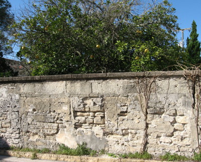
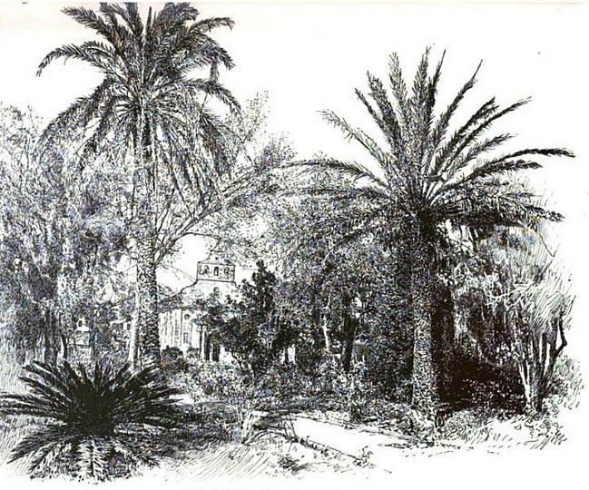
Worn coquina wall in St. Augustine.
But Jim's little woman's eyes glittered with strange light as she hurried on in the shadow of the high wall, where the orange boughs hung over, and beyond these, great branches laden with golden clusters of ripening loquats.
The photograph above illustrate a fruit tree -- in this case a grapefruit -- hanging over a high wall.
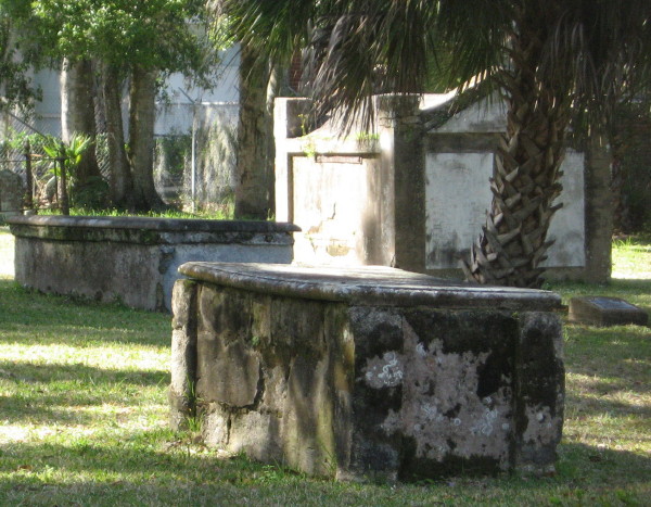
Tolomato Cemetery (Old Spanish Cemetery) in St. Augustine is on Cordova St. between Orange and Saragossa Sts, just west of Fort Marion. The site served as a Christian Indian village of Tolomato and then became a Catholic burial ground in the 18th and 19th centuries. See Karen Harvey (1997) for a summary history of this cemetery (pp. 179-81).
The bishop stopped Jim one day on the plaza, and told him that he must come to church sometimes for his mother's sake: she was a good little woman, and had said many a prayer for her boy.
Marty felt dizzy, and had to lean for a minute against the old cathedral doorway. There was a drone of music inside; she heard it and lost it; then it came again as her faintness passed, and she ran like a child down the street.
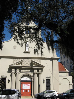
Cathedral Basilica of St. Augustine
Main Door onto Basin St. (now Business 1 / Cathedral Place) and the Plaza.
Closed for renovation in February 2015.
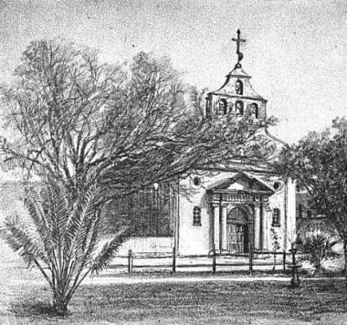
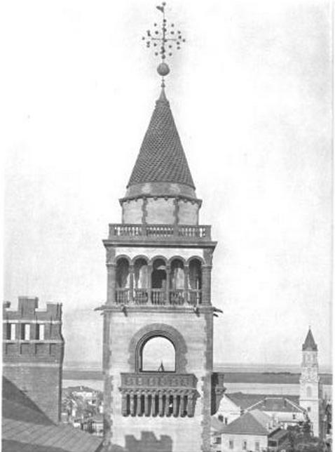
The Cathedral Basilica of St. Augustine before the fire of 1887.
Reynolds, p. 53
The Cathedral Basilica of St. Augustine faces the Plaza on the north side, diagonal from the Government House, which stands west of the Plaza. See Map 3 above, building #1, and Reynolds, pp. 42-51.
The church burned in April 1887 and was rebuilt by 1888, with the assistance of Henry Flagler. Bowen indicates that Flagler specifically was responsible for the addition of the bell tower, but Graham (2014) does not confirm this, stating only Flagler preferred that his substantial support of the reconstruction be kept from public knowledge (p. 106)..
By the time of Jewett's second trip in 1890, the new bell tower would have been added; the tower does not appear on Map 1 or 3. The exterior shell of the cathedral, dating from 1797, survived the fire and was preserved in the rebuilding. Jewett, therefore, is not merely fictionalizing when she characterizes the cathedral and its doorway as old at the time she sets the story.
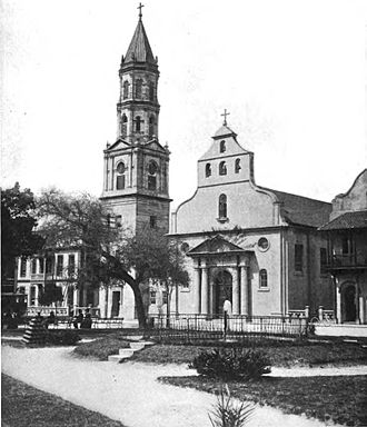
The Cathedral Basilica viewed from the Plaza de la Constitucion after it was rebuilt in 1888.
When the Bishop stopped Jim on the plaza, especially given the flora in the period photos above, the cathedral would have been visible from virtually anywhere on the plaza. See also Map 3.
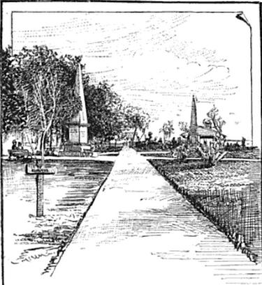
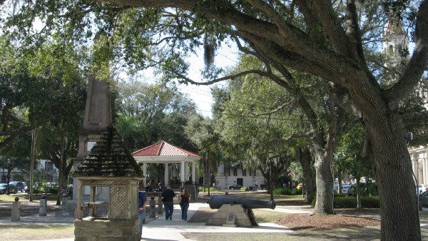
The Plaza
facing east, toward a pair of monuments and the market building.
Reynolds, p. 50.
The Plaza de la Constitucion remains the center of the colonial quarter of St. Augustine, a shady gathering place (probably more shady in 2015 than in 1890) that faces the former plaza basin and harbor, now the Bridge of the Lions to Anastasia Island. It contains significant monuments, perhaps the most important in the period of this story being the Civil War Monument. See Reynolds, pp. 47-51.
Cathedral bell tower visible on right,
coquina Civil War memorial obelisk to left of center.
Notable in comparing images of the plaza area from past and present are the changed foliage, from tall palmetto palms to live oaks, and the number of newer structures.
It is likely that Fields and Jewett attended services at Trinity while in St. Augustine, as this was their denomination.
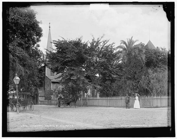
Trinity Episcopal Church and Garden in about 1890
From the corner of George & King Streets.
Detroit Publishing Company Photo from the Library of Congress
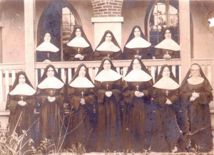
Their quaint garb of black and white.
The Sisters of St. Joseph were invited to St. Augustine to "teach literacy" to newly freed slaves after the American Civil War. According to the history of the St. Joseph Academy, the school was founded in 1866 by Augustin Verot, First Bishop of St. Augustine, who called upon the French Sisters of St. Joseph to operate it. The parish school of St. Joseph in this story, then, was originally a Freedmen's school. From early on located on St. George Street, adjacent to the Sisters of St. Joseph Convent and near the plaza, the academy moved to 155 State Road 207 in 1980.
Site of the St. Joseph Academy in 1890,
convent visible on far right.
Map 4: Detail from 1885 Birds-Eye Map, St. Joseph's Academy
Up is westerly.
Trinity Episcopal Church (#9) is just to the right of center.
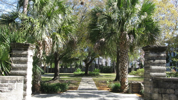
The Sisters of St. Joseph convent remains at 241 St. George Street.
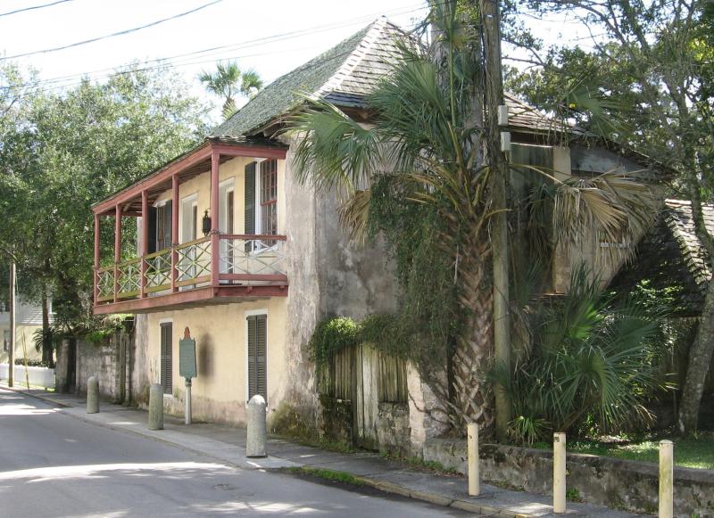
According to Mary Atwood and William Weeks in Historic Homes of Florida's First Coast (89-92), the original convent and school were in the Father O'Reilly house at 32 Aviles St.
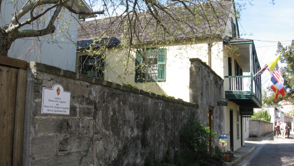
The Father O'Reilly house at 32 Aviles St.,
site of the original convent and school of the Sisters of St. Joseph in St. Augustine.
As they lay out beyond the bar, waiting for enough water to get in, she strained her eyes to see her future home. There was the queer striped light-house, with its corkscrew pattern of black and white, and far beyond were the tall, slender towers of a town that looked beautiful against the sunset, and a long, low shore, white with sand and green here and there with a new greenness which she believed to be orange-trees.
The lighthouse stands on Anastasia Island, east of the city. Designed by Paul Pelz, it was completed in 1874 not long before the previous lighthouse was undermined by shifting shoreline and collapsed. See Wikipedia and Reynolds, 76-8.
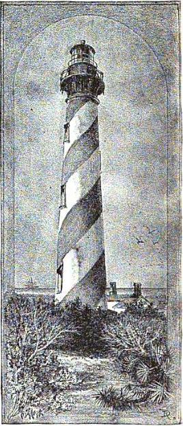 Lighthouse viewed from the south. c. 1890 Reynolds, p. 78 |
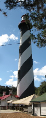 Lighthouse viewed from the north. February 2015 Note that the black and white stripes appear to have been reversed since 1890, probably in repainting. |
Once she went across the bay to the
lighthouse island, -- babies, baby-carriage, the
small hired help, and all, -- and took the railway
that leads down to the south beach. It was a
holiday, and she hoped that from this southern point
she might look far seaward, and catch sight of the
returning sails of the old schooner.... Those
who saw the little company strike out across the
sand to the beach laughed at the sight. The hired
help pushed the empty perambulator with all the
strength she could muster through the deep white
sand, and over the huge green, serpent-like vines
that wound among the low dunes.
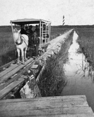
Anastasia Island Trolley (between 1880 and 1899)
From the State Library and Archives of Florida
According to Steven Harvey, the horse-drawn trolley
probably ceased operation in about 1890.
Jewett has described Marty's outing with
considerable precision.
Marty's party would have taken a
ferry to St. Anastasia Island, and caught probably a
horse-drawn trolley to South Beach (See Map 1
above). From this beach, she would have an
unobstructed view to the south, in case the Dawn of
Day might return from the Bahamas during her holiday.
Karen Harvey (1997) reports that
before the first bridge to Anastasia Island was built
in 1895, the South Beach Ferry Company provided hourly
ferry service between the Plaza and the island during
the day, and that the fare included transportation on
a five-mile train to South Beach and stops between
(pp. 50-1). An online
summary of the lighthouse keeper's log indicates
that ferry service may not have been so regular before
1890, when a steam-driven trolley was put into service
for the South Beach trip. See Steven Harvey, Building
America's
Main Street Not Wall Street
(Author House, Apr 7, 2010, pp. 112-118) for an
account of the change to the new ferry and train
service that occurred between 1888 and 1890.
It is unclear in the story which
service Marty and her family used for their excursion,
the old or the new.
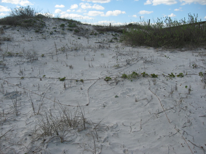
Near South Beach on Anastasia Island
... he showed her the gray old fort one afternoon ....
The gray old fort is Fort Marion at the north end of Bay Street, now a national monument, the Castillo San Marcos (see Map 2, and Reynolds, pp. 52-67).
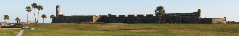
Castillo San Marcos
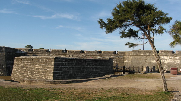
Close-up of Coquina Wall of the
Castillo San Marcos
They went together to do their marketing, and he showed her the gray old fort one afternoon and the great hotels with the towers.
The winter days dawned with blue skies and white clouds sailing over; the town began to fill with strangers....
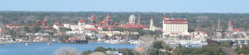
Looking northwest.
The above photo shows the hotel towers of St. Augustine, and other towers as well.
- On the far right, the tower belongs to Grace Methodist Church, (1887) built by Henry Flagler.
- The multi-story building on the right, The Treasury on the Plaza (1928) stands on the north side of the Plaza, east of the cathedral.
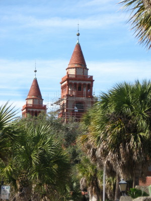
- The first tower to the left of this is the cathedral bell tower, which may have been donated by Henry Flagler after the fire of 1887.
- To the left of the bell tower is the smoke-stack of the Ponce de Leon power plant. Henry Flagler's hotels made extensive use of electric lighting and steam heating. The generating plant was provided by the Thomas Edison Company (Graham 2014, pp. 126-7).
- The dome that appears next on the left belongs to the Memorial Presbyterian Church built by Henry Flagler.
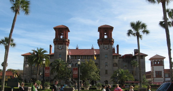
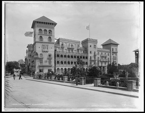
- Next on the left is the matching pair of towers of Flagler's Ponce de Leon Hotel (January 1888).
- The next square tower with three windows and the shorter terracotta roofed tower to the left of it belong to the Casa Monica Hotel (January 1888), which was not built by Henry Flagler, though he purchased it soon after it was built. He renamed it the Hotel Cordova.
- The final pair of towers on the left belong to the Alcazar Hotel (December 1888), the roof line of which extends to the left side of the frame.
When Marty first arrived in St. Augustine, the Treasury Building was absent; therefore, virtually all of the towers visible to her on the skyline were built or owned by Henry Flagler.
- Missing from the above contemporary photo is another set of towers, those of the San Marco Hotel, visible at the far right in the photo below. Opened in 1885, the San Marco burned in 1897. Henry Flagler's 1885 stay in Isaac Smith Crufts' new hotel is believed to have inspired him to make a tourist center of St. Augustine (Graham 2014, p. 44).
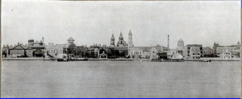
San Marco Hotel, 1885-1897
from Bronson's History
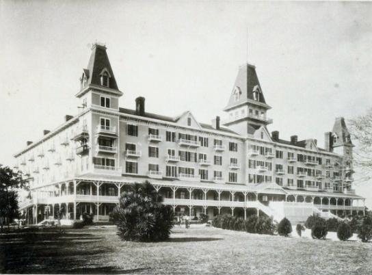
The Alcazar Hotel, now the Lightner Museum
Opened in December 1888.
Included casino, pool, stream room, gym, tennis courts,
and other facilities for amusement and health.
See Graham (2004), pp. 42-55.
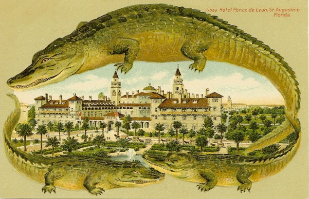
Circa 1909 Postcard of the Hotel Ponce de Leon
Courtesy of Wikipedia
The story mentions that stuffed alligators were for sale on George St.
with ornaments like the berries of the chinaberry-trees.
These towers housed water tanks for the hotel (Graham 2014, p. 128-9).
from Picturesque St. Augustine
by Edward Bierstadt.
The Artotype Publishing Co., 1891
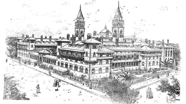
In his Standard Guide, Reynolds devotes pp. 25-42 (out of about 80 pages of text) to the Ponce de Leon Hotel, with many illustrations of its features, and he gives another full page to the Alcazar. Both hotels are gray in color, being among the earlier large American buildings constructed from poured concrete. Their terracotta tiled roofs and decorations make them appear colorful despite the basic gray of the walls.
In this illustration, the left face, with its main gate to the garden and loggia, is the south side, on King Street. The right face is the east side, on Cordova (see Map 2 above).
Thomas Graham (2004) details the planning and construction of Flagler's hotels.
The Ponce de Leon was begun on 1 December, 1885, and completed in May 1887, with a grand opening in January 1888 (Graham 2004, p. 23, 27-8).
To advertize his hotels and St. Augustine as a winter resort, Flagler arranged for the distribution of Florida, the American Riviera. St. Augustine, the winter New Port. The Ponce de Leon, the Alcazar. The Casa Monica, by his New York architects, Carrière & Hastings
(Printed by Gilliss Brothers & Turnure, New York: The Art Age Press, 1887).
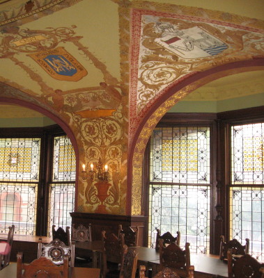
Dining Room of the Ponce de Leon Hotel
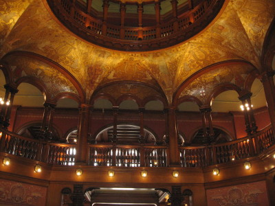
Foyer balcony of the Ponce de Leon Hotel
In midsummer the streets are often empty at midday, and the old city seems deserted. Marty sometimes took the children and sat with them in the plaza, where it was shady. Often in the spring they all wandered up the white pavement of the street by the great hotel to see the gay Spanish flags, and to hear the band play in the gardens of the Ponce de Leon; but the band did not play as it used.
The story takes note of differences between the spring, when the hotel crowds lingered in good weather, and midsummer, when the northern guests have departed, and the city seems deserted. In summer, the plaza offers a cool place to relax, but in cooler weather in the spring, Marty and the children could enjoy free entertainment, given in the gardens of the Ponce de Leon.
Graham (2014) reports that soon after the 1888 opening of the Ponce de Leon, three flag poles were erected at the front of the hotel. The two at the sides of the entrance flew "the red and gold banners of old Spain," while a larger pole at the southeast corner of the hotel displayed an American flag (p. 161).
Graham (2014) says that the Ponce de Leon was one of the hotels that employed bands during the winter seasons of 1888 through 1890. Had Marty passed the Ponce de Leon during the January - April period of 1888 or 1889, she could have heard two performances per day, morning and afternoon, of Maurice J. Joyce's Military Band, including a program of sacred music on Sunday morning (175). These performances took place in the loggia of the Ponce de Leon, and so could be heard in the front garden and, probably, on King Street by the hotel gates. Joyce's band was well known, especially in New York, where he and Thomas H. Joyce were prominent entertainers at Saratoga Springs and in New York City.
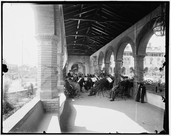
For the 1890 season, Flagler hired a different group, the Ellis Brooks Orchestra (Graham 2014, pp. 221-2).
"Ellis L. Brooks (1848-1920) was a trombonist, composer and popular bandleader.... Brooks directed famous bands in New York and Chicago during the late nineteenth century, and was ranked among contemporaries like Frederick Neil Innes, Patrick Sarsfield Gilmore and John Philip Sousa, both in terms of popularity and critical acclaim." Kalamazoo Public Library.Perhaps because Jewett did not visit St. Augustine in the summer, she may have been unaware that during 1889 and 1890, Flagler kept the Alcazar Hotel open through the summers and employed a smaller band drawn from the winter group to entertain guests daily in the courtyard. If the summer of Jim's long absence occurs during one of those years, Marty might well have been able to take her children to hear music even in the summer, when most of the winter visitors had left (Graham 2014, p. 212).
Illustrations of the Ponce de Leon above show extensive gardens around the hotel, including an open area across King St. in front of the Alcazar.
Cordova Hotel c. 1889, (now the Casa Monica)
Opened in January 1888.
Detroit Publishing Company / Library of Congress
The third major hotel with towers at the time the story is set.
This is the west side, which faces the Alcazar garden.
Link to Bronson's History accounts of its early history.
Did Marty Work for the Flagler Hotels?
Some young women hired all her spare rooms, and paid well for their lodging, besides being compassionate and ready to give a little lift with the housework when they had the time.... One day Marty wrote to her own old friend, and asked her to come down by the steamer to Savannah, and then the rest of the way by rail, to make her a long visit. There was plenty of hotel work in the town; her lodgers themselves got good wages on George Street.
The story is ambiguous about where Marty and her female boarders work. It seems clear that Marty's work consists in part of doing laundry and that she performs this work away from her home. The Flagler hotels had their own laundry, but this was located on Ribera and Valencia Streets near the hotels, not on George Street. Graham (2014) says that the Flagler hotel laundry workers all were women, but apparently both Black and White. The upper stories of the laundry provided racially segregated dormitories for female temporary workers.
It is unclear whether Marty's boarders also do laundry, but they are said to work on George Street. Marty works with other women at her laundry, but it is not clear where this is located. On the day she learns of Jim's supposed death, she is passing by the cathedral on her way to work at mid-day. She seems not to have come by Bay Street, or she would have seen the Dawn of Day immediately. Rather, she seems to have taken Charlotte Street to the Plaza, then turned west toward the cathedral, not thinking to look toward the bay until she notices children carrying over-ripe fruit away from the harbor. Given her apparent route to work, it is possible that she was on her way to the Flagler laundry. Also relevant is the fact that when Marty suffers from the disappearance of Jim, the "hotel people" help her with presents of money and clothing, implying that she is known to hotel employees. However, there were many smaller hotels in St. Augustine, where she might have worked in a laundry.
Union Station, Pavements and Streets
One afternoon when the cars stopped at the St. Augustine station,...
... the white pavement of the street by the great hotel ....
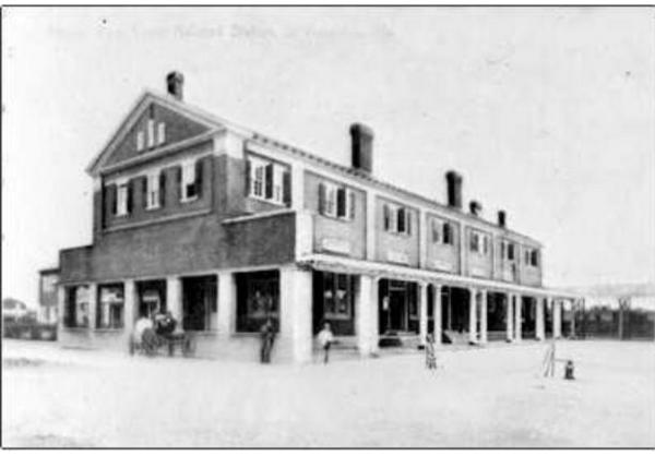
Union Passenger Depot, St. Augustine
c. 1890
from Bronson's History of St. Augustine.
More photos of Union Station
Henry Flagler built on Malaga Street a new St. Augustine train station along his new rail line to bring visitors and supplies to his hotels (See Map 2).
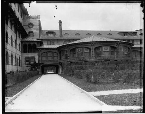
Thomas Graham (2014) reports that Henry Flagler gradually paved streets between the train station and his hotels and around the hotels. The photograph below shows the east driveway, running between Cordova and Sevilla, by which guests and luggage arrived at the Ponce de Leon, passing next to the round dining room and unloading in the sheltered area beneath. This was the first drive that Henry Flagler paved in asphalt in 1888. By the end of that 1889, Flagler had paved the blocks surrounding the Alcazar and Ponce de Leon, and Valencia St. from the train station to Cordova. (Graham 2014, p. 150, 188).
It is somewhat mysterious how the pavements came to appear white, as the story reports and as is seen in the photograph below. Indeed, all photographs of the Flagler hotels show either unpaved or white streets around them, as does the above photo of the passenger station. Bronson's History indicates that the new train station area was paved in asphalt during 1889. Asphalt uses a black bitumen binder to make concrete. According to Graham (2014), this black material "came into the harbor on schooners in a powdered form and was then spread upon a base of concrete, heated by a massive roller, and pounded level by a force of men with hot iron mauls" (p. 188).
Paving streets reduced the dust and discomfort for guests arriving at luxury hotels. When bicycling became popular in the 1890s, extensive paved streets made the pastime more practical (Graham 2004, p. 59-61; 2014, p. 190). Graham (2014) also suggests that paving streets was in part a response to outbreaks of yellow fever, which were thought to be caused by unsanitary, difficult to clean sand streets and a lack of sidewalks.
View from Cordova Street, from Bronson History.
Dated between 1895 and 1910.
Though the Bronson page credits this photograph to the Detroit Publishing Company,
it does not currently (2015) appear on the Detroit page.
Coquina house and wall on the left.
Reynolds, p. 11.
King Street c. 1890
from Picturesque St. Augustine
by Edward Bierstadt.
The Artotype Publishing Co., 1891
Lumbering carriages clattered along the palmetto pavement,...
As Jewett indicates, some St. Augustine streets were paved with wood. Here she seems to refer to George St., though in the Reynolds illustration, below, George St. was not paved at the Old Gates. Graham (2014) reports that a number of streets were paved with uniformly trimmed, 4-inch sections of cypress logs, including the streets around the Plaza and St. George St. from the Plaza to the Gates. Most of this work was completed by the summer of 1889 (188-90). This account includes a photograph of cypress block street construction (p. 189). While Graham indicates that cypress exclusively was used for this paving, Robert F. Nawrocki, of the St. Augustine Historical Society, says that palmetto trees also were used for this purpose. How Marty or Jewett would have distinguished cypress from palmetto pavement is uncertain.
The St. Augustine Record (July 26, 2002) reported uncovering some surviving wooden pavement during a repaving project. The story explains:
"A felled log was sawed into segments -- much like store-bought cookie dough is sliced. Each segment was stacked in the 20-foot-wide graded road, with the logs being held in place by a wooden border. Sand was then laid in the spaces. Unfortunately, residents soon learned that the wood absorbed water, softened, rotted and quickly became worn. "The pavers were more trouble than they were worth," Halbirt [City Archaeologist Carl Halbirt] said.... An article in the Oct. 11, 1895, issue of The Florida Times-Union said the city's "board of aldermen decided last night that no more shells and sand shall be used to top-dress the decayed cypress blocks on St. George and any other thoroughfare, as it was throwing money away."
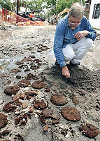
Carl Halbirt, St. Augustine City Archaeologist
examines remains of cypress pavement in July 2002.
Image from St. Augustine Record.
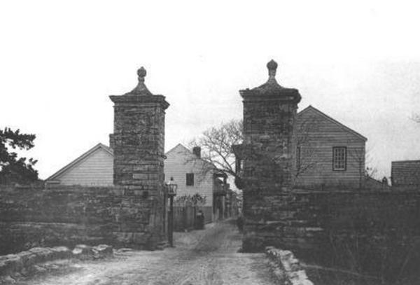
"That old bishop o' my mother's," faltered Jim. "He's been givin' it to me; he catched me out by the old gates, ...
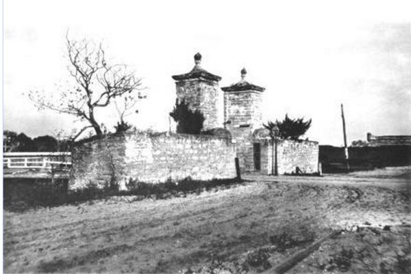
The remains of gates of the old walled city stand at the north end of George Street. See Reynolds, pp. 44-6.
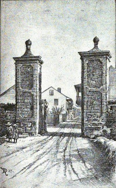
The Old Gate
Looking south down St. George Street.
Reynolds, p. 45
The Old Gate c. 1890
from Picturesque
St.
Augustine
by Edward Bierstadt.
The Artotype Publishing Co., 1891
Looking south down St. George St.
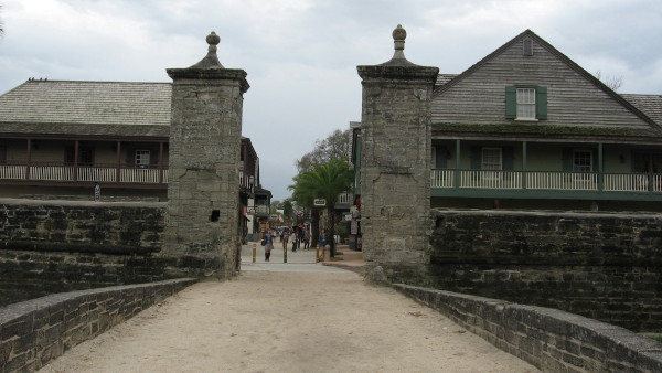
South view from the Old Gate down George St.
February 2015
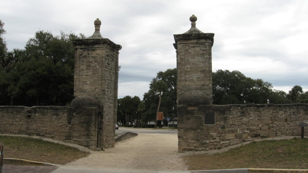
The Old Gate, looking north, from George Street.
The Old Gate c. 1890
from Picturesque St. Augustine
by Edward Bierstadt. The Artotype Publishing Co., 1891
Looking eastward toward Fort Marion.
Reynolds p. 20
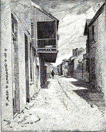
St. Georges Street
Reynolds, p. 10
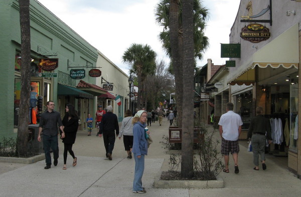
George St., looking north
February 2015
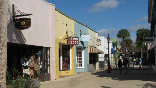
Close view of shell shop on George St.
They tried to walk on the sea-wall, and one man fell over and was too drunk to find his way ashore, and lay down on the wet, shelly mud. The tide came up and covered Joe Black, and that was the last of him, ...
Looking north along Bay Street and the seawall.
The pier beyond the bathing house would have stood at the head of Baya Lane, before fire razed this area in 1895.
Detroit Publishing Company Photo from the Library of Congress.
Dated 1902
As this and other photos and illustrations indicate, walking on the sea wall was not unusual. In this incident, then, the problem for Joe Black seems to be walking on the wall at night while drunk and in the company of others too inebriated to notice his fall.
Looking southward from the Bridge of the Lions.
St. Augustine
Reynolds, p. 16.
... when she heard the sunset gun from the barracks it startled her terribly.
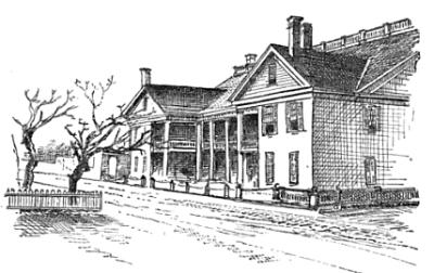
United States Military Barracks
Reynolds, p. 70.
The United States Military Barracks or St. Francis Barracks, according to Reynolds (p. 70), was built by the British in 1763 on the site of a Franciscan convent. Reynolds says "The out-door concerts given by the military band, the dress-parades and the guard-mount at sunset on the parade in front of the barracks" were tourist attractions in the 1880s and 90s. Presumably the sunset gun was part of the evening guard-mount on the parade ground.
Up is westerly.
This map detail shows the Military Barracks on St. Francis Street at the southern end of Bay St., including a small boat basin, the parade ground on which the sunset gun was fired, and the barracks (#5). According to the map legend, all of the areas labeled 5 are parts of the barracks. The cannon, presumably fired at sunset, projects over the sea wall south / left of the pier.
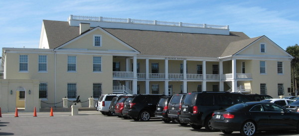
United States Military Barracks
In 2015, the parade ground has become a parking lot.
Though the original barracks were damaged by fire, the current building follows the same plan, as seen in a comparison of the photograph with the illustration and Map 5 above.
He went to work on one of the new harbor jetties
at his wife's recommendation, and did good service.
The St.
Augustine.com time-line for
1887 includes this entry: "A survey of the St. Augustine harbor
was conducted between May and June. The surveyors,
David DuBose Gaillard and William Murray Black,
proposed the construction of jetties extending from
both North Beach (Vilano Beach) and Anastasia Island
spaced 1,600 feet from each other. Galliard and
Black produced a map of their
survey, published
in 1889. Their proposals led to creation of today’s
16-foot deep channel into St. Augustine’s harbor."
David
du
Bose Gaillard 1859-1913) "was a U.S. Army
engineer instrumental in the construction of the
Panama Canal."
William
Murray
Black (1855-1933) "was career officer in
the United States Army, noted for his ability to
organize and train young engineers."
The Report
of
the Chief of Engineers U.S. Army, Part 2
(United States Army Corps of Engineers: U.S.
Government Printing Office, 1893) describes the work
that was completed between 1888 and 1890 on
"Improvement of the St. Augustine Harbor, Florida"
(1653-5).
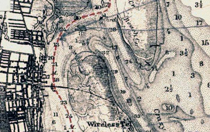
Further work was added late in 1890 and through 1893, by which time seven groins had been built. Historic Stucture Report, Fort Matanzas National Monument, Florida by Fort Matanzas Stabilization Team (1980, p. 153) summarizes a 1935 report that three of the groins had fallen into disrepair and needed replacement.With the appropriation of $35,000, made in the act of 1888 three groins were built: No. 1, on Anastasia Island, near the northern boundary of the United States light-house reservation; No. 2, on North Beach at the point; No. 3, on the North Beach, about 2000 feet from the point.
These groins all consist, essentially, of a foundation of brush fascines, covered with riprap and capped with concrete blocks which are 2 feet wide on top and have side slopes of 1 on 2. (1654)
Given the dates provided, it would seem clear that Jim worked on the first three jetties within the time-frame of the story. Later reconstructions and other projects were necessary to produce the current St. Augustine harbor.
The following detail from a 1911 coastal survey map may show surviving jetties on North Beach, the two dark lines extending outward from the shore at the southern tip and another just north of this on the east coast of North Beach.
The wireless telegraph is located just north of the lighthouse on Anastasia Island.
Sawmills
He worked at loading the schooner down at the sawmill, ...
... the schooner Dawn of Day had come up from the sawmill wharf with a tug, and sent a boat ashore for Jim.
Up is westerly.
The bridge, partially visible in the upper right corner, connects King Street with the New St. Augustine Road (see Map 1). A citrus grove probably stands across the river from the mills.
Main Contents & Search
A Native of Winby