A Photographic Journey to Pine Hill from South Berwick --
September - October 2002
By Wendy Pirsig and Norma Keim, Old Berwick Historical Society
with assistance of Nancy Cook, Clare Gillingham, and Terry
Heller
Photographs by Wendy Pirsig and Terry Heller
This document has two main purposes: to illustrate the
historical faithfulness with which Sarah Orne Jewett depicted
the geography of her region in her historical novel, The
Tory Lover (1901) and to show how some the areas she
describes appear more than two centuries after the era she
depicts and a century after she composed her book. Twice
in the course of the novel, Mary Hamilton takes her horse to
visit Master John Sullivan at his Pine Hill home, first in
Chapter 16 to talk over Roger Wallingford's joining John Paul
Jones on the Ranger and leaving his mother exposed to an
unruly anti-Tory mob, second to seek his help in freeing Roger
from the Mill Prison at Plymouth in England. Mary's first
trip is described in enough detail that one can retrace it two
centuries later, observing what remains of the old roads and
identifying several specific sites along the way.
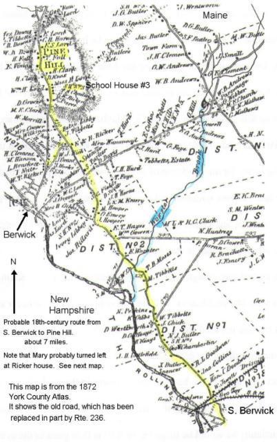
Detail from the 1872 York County, Maine Atlas.
The probable route between South Berwick and Pine Hill
in 1777-8 follows the yellow line. This line begins at
Hamilton House and ends at Pine Hill, about 7 miles. Mary,
however, would have turned left at the Ricker house -- see next
map -- to take what is now Sullivan Street to the Master
Sullivan Farm. Pine Hill is just north of Berwick, ME
today. Hamilton House is on the southern edge of South Berwick,
ME today. To the west of the road is the Salmon Falls
River, marking the border between Maine and New Hampshire. (TH)
Detail from the 1872 York County, Maine Atlas. (WP)
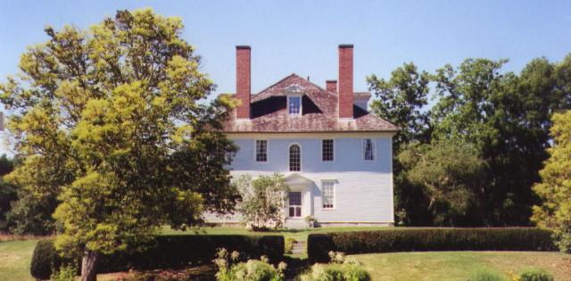
Hamilton House - East Side (TH)
In Chapter 16, Mary leaves Hamilton House in the morning.
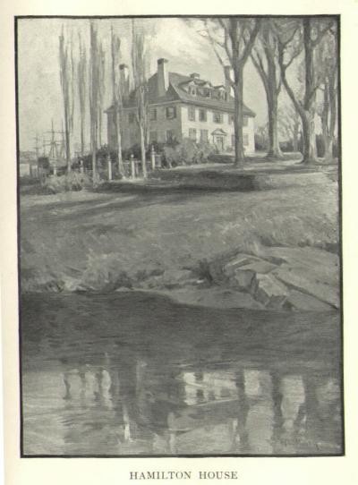
Image by Charles H. Woodbury that appears in the novel,
showing the west side of the house, with its terraces toward
the river.
Notably absent from this image is the Lower Landing, which was on
this side of the house. The landing included a wharf,
counting house, warehouse, and other buildings associated with
trade and shipping. Behind the house on the left appear the
masts of ships, but, unless they are far up-river, these would
have to be in what Mary describes as the field to the north and
east of the house.
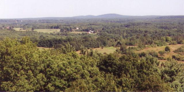
The Three Hills of Agamenticus -- Seen from Garrison Hill
in Dover, NH (TH)
"The fields of Berwick were already
beginning to wear that look of hand-shaped smoothness which
belongs only to long-tilled lands in an old country."
"The northern mountains were as blue
as if it were a day in spring. They looked as if the warm mist
of April hung over them; as if they were the outposts of another
world, whose climate and cares were of another and gentler sort,
and there was no more fretting or losing, and no more war either
by land or sea."
South Berwick village is near the horizon on
the left side of this photo. We can see that the fields of
Berwick have, to a considerable extent, returned to woods.
Though not especially visible in this photo, the woods and
fields of Berwick are fairly rapidly developing into
rural/suburban residences for people who work in the Portsmouth,
NH - Boston, MA region.
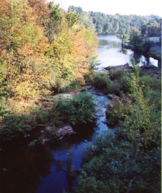
Salmon Falls between South Berwick and Rollinsford --
Looking South --
as it might have appeared to Mary Hamilton (TH)
"The road was up and down all the way over the hills, winding
and turning among the upper farms that lay along the riverside
above the Salmon Fall."
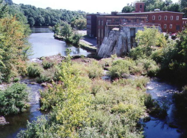
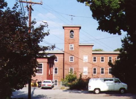
Salmon Falls -- Looking South -- about as it appeared to
Jewett (TH)
with the mill in Rollinsford, NH on the right.
Below is a view of this same mill building from within
Rollinsford (TH)
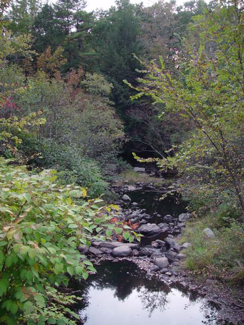
Worster Brook (WP)
"There was the ford to cross at Wooster's River...."
"The road still led northward along
the high uplands above the river; all the northern hills and the
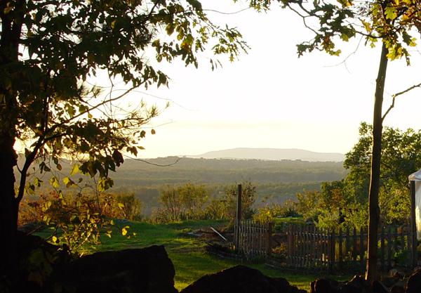
mountains of Ossipee looked dark now, in a solemn row."
"On the heights of the great ridge some of the elder generation
of trees were still standing, left because they were crooked and
unfit for the mastships' cargoes. They were monarchs of the
whole landscape, and waved their long boughs in the wintry wind.
Mary Hamilton had known them in her earliest childhood, and
looked toward them now with happy recognition, as if within
their hard seasoned shapes their hearts were conscious of other
existences, and affection like her own. She stopped the fleet
horse on the top of the hill, and laid her hand upon the bark of
a huge pine; then she looked off at the lower country. The sight
of it was a challenge to adventure; a great horizon sets the
boundaries of the inner life of man wider to match itself, and
something that had bound the girl's heart too closely seemed to
slip easily away."
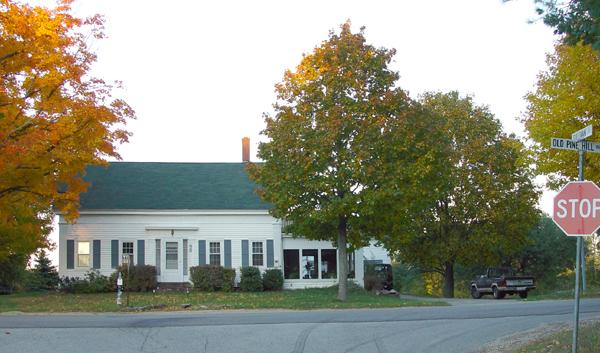
Facing East at Old Pine Hill Road. (WP)
As can be seen from the sign to the right of the picture, this
farmhouse stands at the corner of Old Pine Hill Road and
Sullivan Street. It is likely that of E. and B. Ricker marked on
the Pine Hill map above. Jewett would have turned at this corner
had she visited the scene of Mary's ride to Master Sullivan's.
Someone coming from South Berwick would have approached from the
right, then turned toward the camera, down Sullivan street.
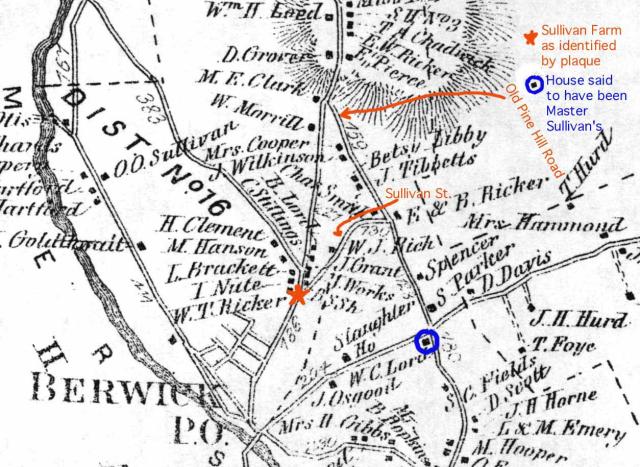
Sites Associated with Master Sullivan
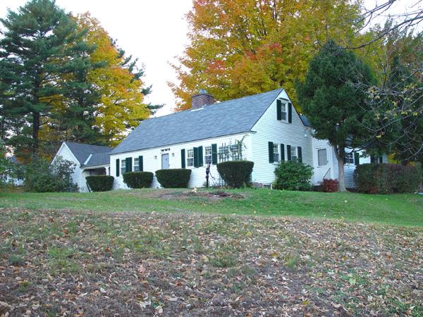
Possibly the remodeled Master John Sullivan School
House -- (WP)
One section of this house at 134 School
Street / Route 9, in Berwick is believed to be Master
John Sullivan's school, which was moved from its
original location -- see Pine Hill map, above and the
news clipping to the right. This view was taken from
Old Pine Hill Road looking at the present rear of the
house. The next photo was taken from School Street
(Rte 9), showing the front of the house with a wide
lawn. We can see that the house is made up of two or
three smaller buildings. This house was identified by
Clare Gillingham and Nancy Cook. The residents
at the time of these photos were named
Pineo.
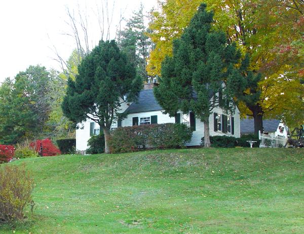
View of possible Sullivan school
house from Old Pine Hill Road, looking southward.
(WP)
|
From an unidentified newspaper
after 1945.
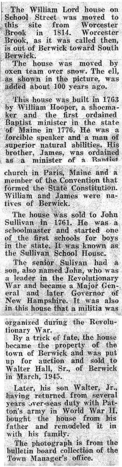
|
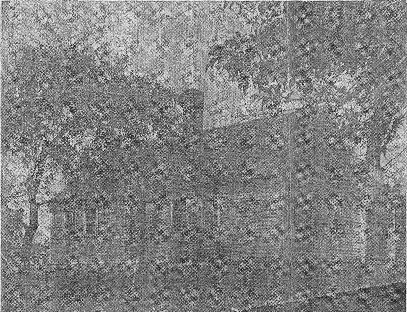
Photograph of the house believed to be Sullivan's school
moved and remodeled. This is the photograph
referred to in the above newspaper clipping.
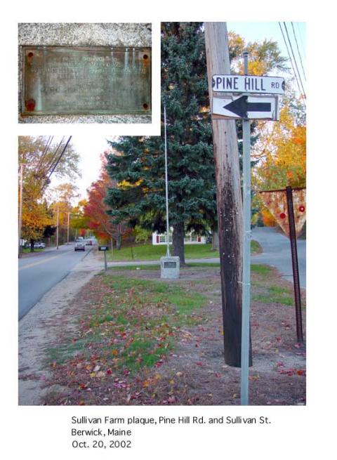
This marker indicates the location of the original Master John
Sullivan farm site in Berwick, near the actual hill called Pine
Hill. The marker stands at the fork formed by Sullivan
Street and Pine Hill Road (not Old Pine Hill Road). We are
looking north, up Pine Hill. Sullivan Street is the road to the
right. Winslow Street and the original location of the family
burying plot are off Sullivan St., out of view to the right.
It may be helpful to note that in the 1770s,
what is now South Berwick was known as Berwick village, and at
least part of what is now known as Berwick, was then Pine
Hill. Therefore, though the Sullivans lived at
Pine Hill, they did not necessarily reside on Pine Hill.
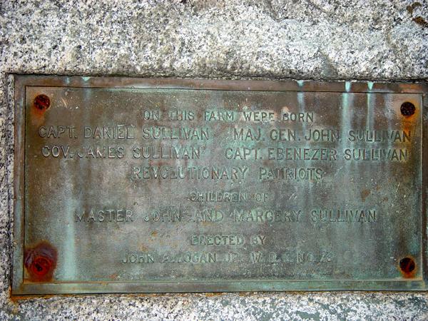
Next is a close-up of the plaque on the
marker. (WP)
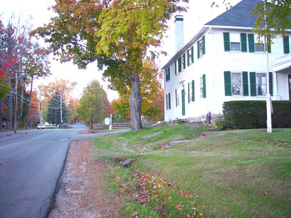
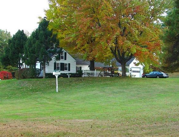
House Currently at the Sullivan Farm Site (WP)
Looking north along Sullivan Street from below the marker shown
above, which stands at the evergreen tree in the background toward
the left. The beautiful early 19th century house in the foreground
is Goodwin Insurance. It is shown as part of a tannery
complex on the Berwick map of 1872 (Pine Hill map above).
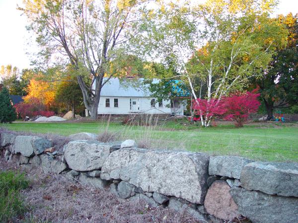
Approximate Site of School House No. 3 -- See maps.
(WP)
The actual location of Master Sullivan's school is not known; this
is a possible location, though it is up the hill from his
farm. The above news clipping indicates the school
originally stood on Worcester / Worster Brook, which would be some
distance south of the Sullivan farm. Note that the home in
the photograph is not the 19th-century building marked as
School House No. 3 on the maps above.
Revised December 2012